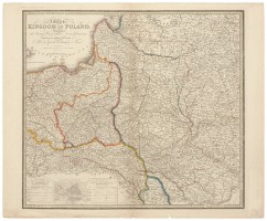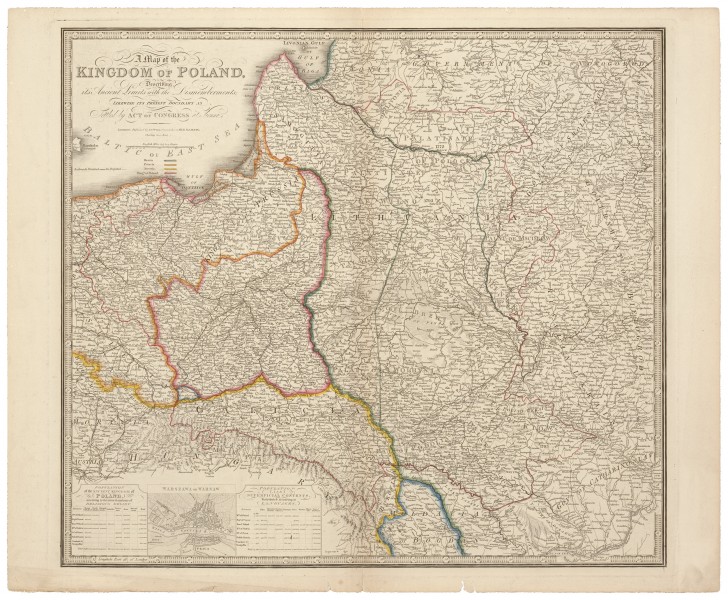
A Map of The Kingdom of Poland, Describing it's Ancient Limits with the Dismemberments; Likewise it's Present Boundary as Settled by Act of Congress at Vienna
| Autorius: |
Jamesas Wyldas (1790–1836)  |
| Sukūrimo metai: | 1823–1847 |
| Medžiaga: | popierius |
| Technika: | vario raižinys |
| Išmatavimai: | 54 × 60.50 cm |