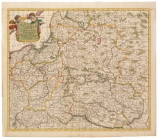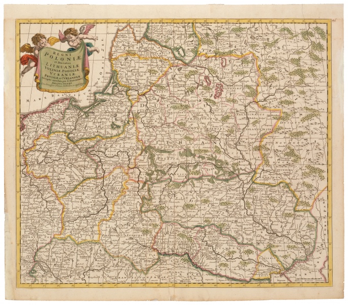
Regni Poloniae et Ducatus Lithuanie...
| Author: |
Justus Danckerts (1635–1701)  |
| Created: | 1700 |
| Material: | paper |
| Technique: | copper engraving |
| Dimensions: | 49 × 58 cm |

Initially, the Danckerts map publishers worked in cooperation with Frederick de Wit, but later began to compete with him in the market. Each firm wanted to publish atlases compiled from its prepared maps. De Wit began to put a substantially transformed map of the GDL, based on the original map by Johannes Blaeu, into his atlases, while the Danckerts produced their own new map of the GDL. This circumstance allows us to establish, at least approximately, the date of creation of the GDL map, which cannot be earlier than 1690.
Source: Law firm Valiunas Ellex art album LITUANIA IN ATLANTIBUS (2011). Text author Algimantas Muzikevičius