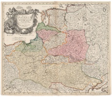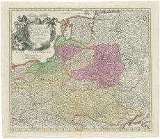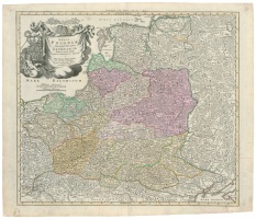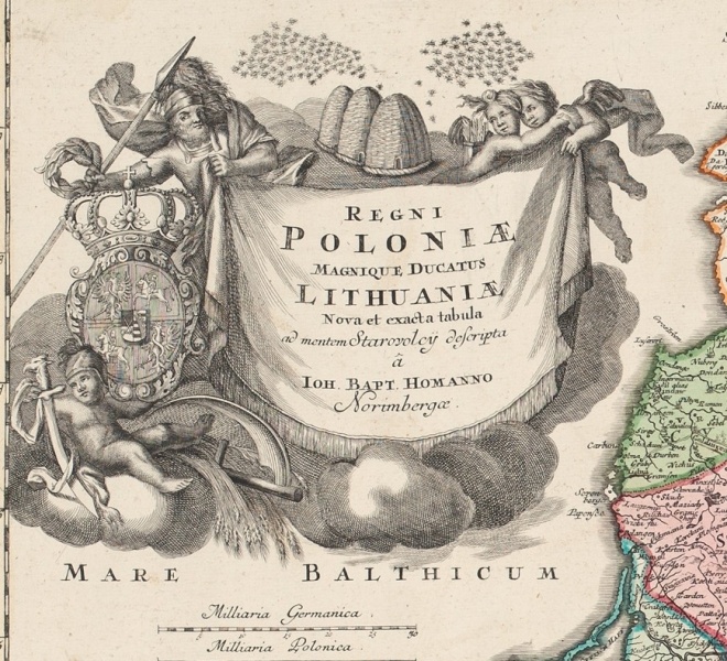


Regni Poloniae Magnique Ducatus Lithuaniae Nova et exacta tabula…
| Authors: |
Simon Starowolski (1588–1656) Johann Homann (1664–1724) |
| Created: | 1710 |
| Material: | paper |
| Technique: | copper engraving |
| Dimensions: | 49.50 × 57.50 cm |

The Johann Baptist Homann map Regni Poloniæ Magnique Ducatus Lithuaniæ is the best known, and most probably was published in the largest number of copies as 11 versions (and even more issues) of that map are known. The maps were printed from 3 different printing plates, which were constantly updated and supplemented, and the maps therefore differed not only by the texts in their cartouches (dates, coats of arms, privileges), but also by the cartographic information of the maps. J. B. Homann himself recognised Simon Starowolski (1588–1656), whose name was inscribed in the cartouche, as the author of the map. This map is a rare example reflecting not only changes of state borders but also internal political struggles. When in the Commonwealth in 1706–1709 Kazimierz Leszczynski and August II struggled for the throne and the country was left without a monarch or in diarchy, in the cartouche of the J. B. Homann map, two swarms of bees were depicted and a free space was left in the coat of arms where the king’s personal coat of arms should have been.
Source: Law firm Valiunas Ellex art album DELINEATIO LITUÆ (2009). Text authors Jevgenij Machovenko, Algimantas Muzikevičius, LITUANIA IN ATLANTIBUS (2011). Text author Algimantas Muzikevičius