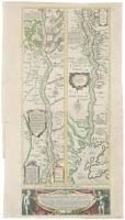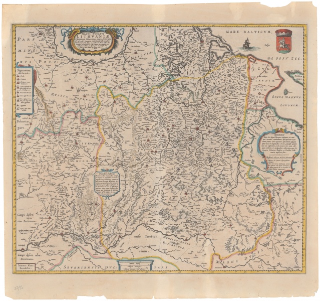
Magni Dvcatvs / Lithvaniæ et Regionum Adiacentium Exacta Descriptio
| Author: |
Joan Blaeu (1591–1673)  |
| Created: | 1648–1672 |
| Material: | paper |
| Technique: | copper engraving |
| Dimensions: | 44.50 × 52.50 cm |

Willem Janszoon Blaeu (1571–1638) and Joan Blaeu (1591–1673) printed the map of the Grand Duchy of Lithuania, initiated by Mikołaj Krzysztof Radziwiłł “the Orphan” (1549–1616), prepared by Tomasz Makowski (1573–1630) and engraved by Hessel Gerritsz (Gherritszoon van Assum, 1581–1632) – the most famous map of the period. The map was issued as a wall map in 1613, as a large atlas version in 1631–1647. With the beginning of the publication of multi-volume atlases in many languages, large GDL maps appeared to be very inconvenient due to folding. Therefore, Johannes Blaeu in 1648–1672 made up a smaller version of the GDL map, which was included into all the other subsequent atlases.
Source: Law firm Valiunas Ellex art album LITUANIA IN ATLANTIBUS (2011). Text author Algimantas Muzikevičius