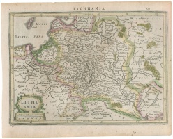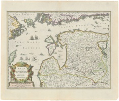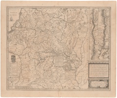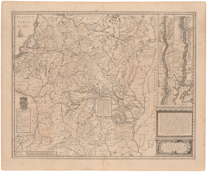

Magni Ducatus Lithvaniae Cæterarumq Regionum illi adiacentium exacta descrip. opera et cura in lucem edita
| Author: |
Johann Janssonius (1588–1664) |
| Created: | 1652–1658 |
| Material: | paper |
| Technique: | copper engraving |
| Dimensions: | 43.50 × 54 cm |

The map of the Grand Duchy of Lithuania in the atlases of Dutch cartographers of the middle and second half of the 17th century replaced the first map of Lithuania by Mercator. There were four issues of the map printed by different publishers from the same printing plate with only insignificant supplements made. The map was published 21 times in various atlases and in several languages between 1636 and 1690. A smaller version of the map was published during the period of 1628–1661 (approximately 15 issues).
Source: Law firm Valiunas Ellex art album DELINEATIO LITUÆ (2009). Text authors Jevgenij Machovenko, Algimantas Muzikevičius, LITUANIA IN ATLANTIBUS (2011). Text author Algimantas Muzikevičius