


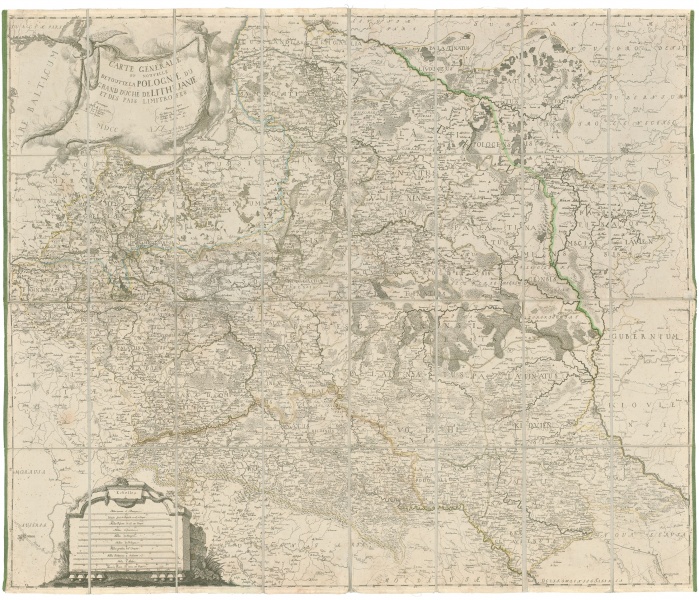
Carte générale et nouvelle de toute la Pologne...
| Authors: |
Bartolomeo de Folino (1730–1808)  Michael Gröll (1722–1798) |
| Created: | 1770 |
| Material: | paper |
| Technique: | copper engraving |
| Dimensions: | 85.50 × 100 cm |

Bartolomeo de Folino created a 24-sheet map of Poland-Lithuania, which was published in Warsaw and used in the Russian-Prussian negotiations regarding the first partition of the Commonwealth. The map was engraved by Michael Gröll.
Source: Law firm Valiunas Ellex art album LITUANIA IN ATLANTIBUS (2011). Text author Algimantas Muzikevičius