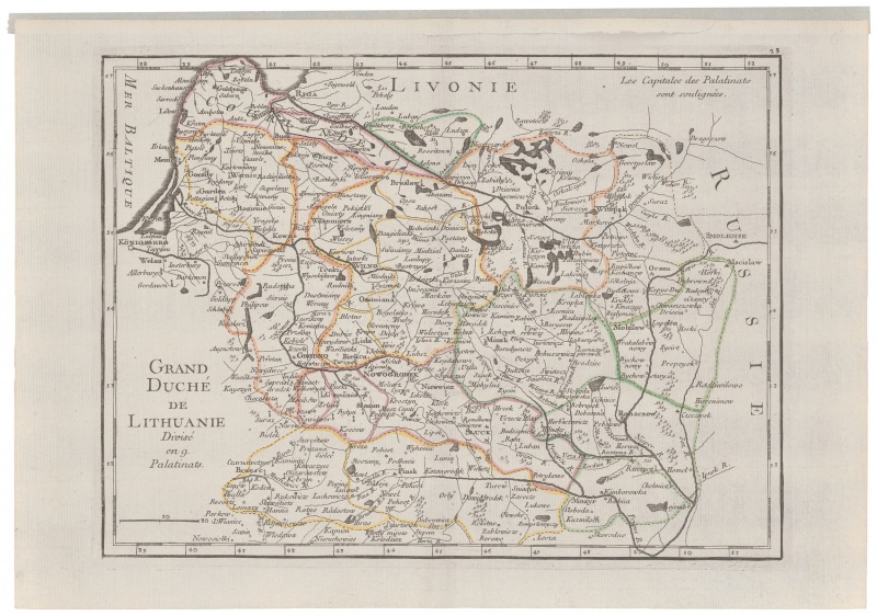

Grand Duche de Lithuanie...
| Author: |
Georges Rouge (1730–1780)  |
| Created: | 1748–1767 |
| Material: | paper |
| Technique: | copper engraving |
| Dimensions: | 20.50 × 27.50 cm |

Le Rouge’s map of the GDL is a contracted modification of the map by J. Nieprzecki and T. Mayer, which is manifestly evidenced by the analogies of Lithuanian place-names. The map was included in the 1748–1767 issues of Atlas portatif.
Source: Law firm Valiunas Ellex art album LITUANIA IN ATLANTIBUS (2011). Text author Algimantas Muzikevičius